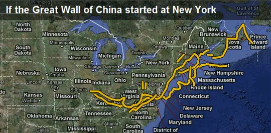
It often becomes a bit easy for us to visualize the size of an area if it is shown relative to something that we are already aware of.
Based on this idea, BBC has launched a new site called Dimensions where you can visualize the scale of important historical places and events by overlaying them on a map of a location that you are already familiar with.
For instance, you can set your city as the starting point for the Great Wall of China to understand how massive it is. Or if you wish to know how much distance did the astronauts walk when they first landed on the moon, simply overlay that area to some familiar neighborhood.
There’s a map of Tora Bora caves in Afghanistan where Laden was thought to be hiding sometime. Once you see that area relative to your own location, you suddenly realize how big it is.
BBC Dimensions is a great concept and there are quite a few good examples to keep you occupied for some time. The website however is not up to the mark.


